mapsExploring Florida
 FL Maps > Region > 1950-1999 > Structural an Isopachous Map of the Miocene in the Northern Portion of the Florida Peninsula, 1951
Site Map 

Structural an Isopachous Map of the Miocene in the Northern Portion of the Florida Peninsula, 1951

Structural an Isopachous Map of the Miocene in the Northern Portion of the Florida Peninsula


Title: Structural an Isopachous Map of the Miocene in the Northern Portion of the Florida Peninsula
Projection: Unknown
Source Bounding Coordinates:
W: E: N: S:

Main Map Page
Zoomify Version
B/W PDF Version
Puzzles: Easy, Medium, Hard
Google Earth
GIS Files
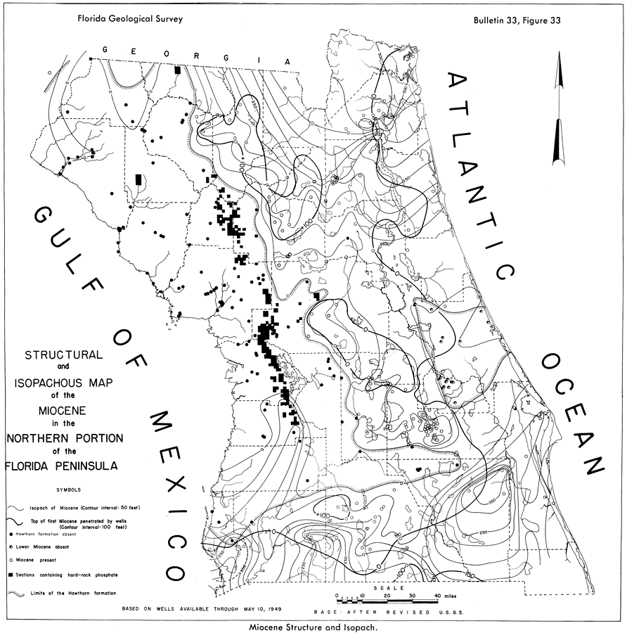
Description: This map from the Florida Geological Survey Bulletin number 33, shows the structures and isopach of the Miocene, including the limits of the Hawthorn formation, areas of hard-rock phosphate, and contours indicating the top of the first Miocene.
Place Names: 1950-1999, Citrus County, Levy County
ISO Topic Categories: boundaries, geoscientificInformation
Keywords: Structural an Isopachous Map of the Miocene in the Northern Portion of the Florida Peninsula, physical, political, kgeology, physical features, geological, county borders, boundaries, geoscientificInformation, Unknown,1951
Source: Robert O. Vernon, Geology of Citrus and Levy Counties, Florida (Tallahassee, FL: The Florida Geological Survey, 1951) 180
Map Credit: Courtesy the private collection of Roy Winkelman
SearchLicensePDF HelpGIS Help Google Earth Help Zoomify Help

 FL Maps > Region > 1950-1999 > Structural an Isopachous Map of the Miocene in the Northern Portion of the Florida Peninsula, 1951
Site Map