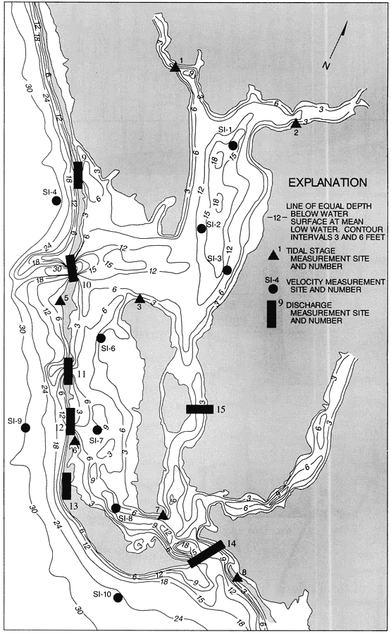
Description: This map from the U. S. Geological Survey Water Resources Investigation Report number 93-4153, Simulation of Tidal Flow, Circulation, and Flushing of the Charlotte Harbor Esturine System, shows the generalized bottom configuration of the Charlotte Harbor esturine system and nearshore Gulf of Mexico. The contour intervals are 3 and 6 feet below water surface at mean low water levels. Included are the tidal stage, velocity, and discharge measurement sites used for collecting data in the report.
Source: Carl R. Goodwin, USGS Water Resources Investigations Report 93-4153 (Tallahassee, FL: U. S. Geological Survey, 1996) 47
Map Credit: Courtesy the University of South Florida Library |
|