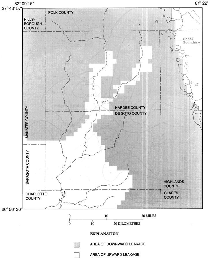
Description: This map from the U. S. Geological Survey Water Resources Investigation Report number 93-4158, Hydrology and Simulated Effects of Groundwater Withdrawals for Citrus Irrigation, Hardee and De Soto Counties, shows the areas in Hardee and De Soto counties of upward and downward leakage through the upper confining unit of the intermediate aquifer system in September, 1988. The intermediate aquifer system underlies all of Hardee and De Soto counties and is hydraulically separated from the surficial aquifer by the upper confining unit. For most of the study area the upper confining unit retards hydraulic interaquifer flow, however, it does transmit, or leak, water downward from the surficial aquifer, and upward into the Peace River, and the system is referred to as a leaky-aquifer system.
Source: P. A. Metz, USGS Water Resources Investigations Report 93-4158 (Tallahassee, FL: U. S. Geological Survey, 1995) 15
Map Credit: Courtesy the University of South Florida Library |
|