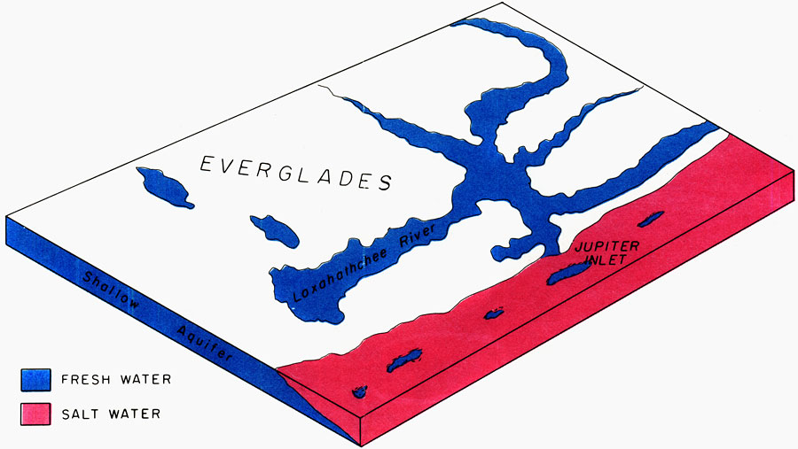
Description: This is a map showing how fresh water was not threatened by encroaching sea water around the year 1880. Blue is fresh water and pink is salt water. "Before the turn of the century (about 1880) fresh water flowed to the ocean through Jupiter Inlet, and fresh-water springs seeped from the ocean floor. Streamflow and the water table were high enough to hold sea water at the coast." — Florida Bureau of Geology. It is connected to a map of Palm Beach County showing encroaching sea water current to 1973 which you can find here. Please see the article Encroaching Salt Water in Northeast Palm Beach County by Harry G. Rodis for more information.
Place Names: Palm Beach, Loxahatchee River, Atlantic Ocean, Jupiter Inlet, Everglades
ISO Topic Categories: geoscientificInformation, inlandWaters, oceans
Keywords: Jupiter Inlet Fresh Water, physical, hydrological, geological, geoscientificInformation, inlandWaters, oceans, Unknown,1972
Source: U. S. Geological Survey, Bureau of Geology, Florida Department of Natural Resources, Florida Bureau of Geology (Tallahassee, FL: Florida Bureau of Geology, 1973)
Map Credit: Courtesy the University of South Florida Library |
|