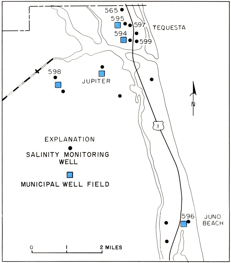
Description: This is a map showing data from monitoring wells in northeast Palm Beach County, current to 1973. It also shows roads, railroads, cities and inland water. "Data from wells monitoring sea-water encroachment show that declining water levels in most wells coincide with an increase in salinity (chloride) in the water-bearing zones tapped by the wells. The sharp rise in the water level and corresponding decline in chloride of water from well 596 at Juno Beach during April 1971 apparently coincided with reduced pumpage of a nearby municipal well, which had become contaminated by salty water." — Florida Bureau of Geology. Please see the article Encroaching Salt Water in Northeast Palm Beach County by Harry G. Rodis for more information.
Place Names: Palm Beach, Tequesta, Jupiter, Juno Beach
ISO Topic Categories: geoscientificInformation, inlandWaters, oceans, transportation, boundaries
Keywords: Monitoring Wells Data in Palm Beach, physical, hydrological, transportation, political, geological, county borders, roads, railroads, water routes, geoscientificInformation, inlandWaters, oceans, transportation, boundaries, Unknown,1973
Source: U. S. Geological Survey, Bureau of Geology, Florida Department of Natural Resources, Florida Bureau of Geology (Tallahassee, FL: Florida Bureau of Geology, 1973)
Map Credit: Courtesy the University of South Florida Library |
|