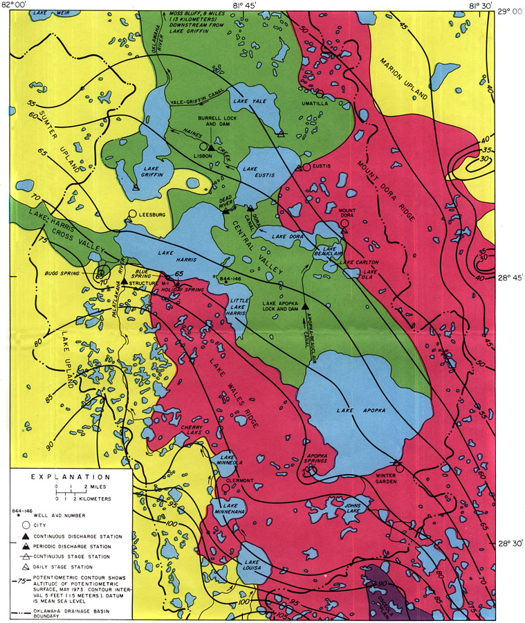
Description: This is a map showing the Oklawaha lakes area, current to 1974. "Lakes Apopka, Carlton, Beauclair, Dora, Eustis, Harris, Little Harris, Griffon and Yale are part of a chain of lakes that is the most prominent feature of the upper Oklawaha River drainage basin in central Florida. For convenience, this chain of lakes is called the Oklawaha lakes in this report, and the lakes in conjunction with their environs, the Oklawaha lakes area." — Florida Bureau of Geology Please see the article Hydrology of the Oklawaha Lakes Area of Florida by P. W. Bush for more information.
Source: U. S. Geological Survey, Bureau of Geology, Florida Department of Natural Resources, Florida Bureau of Geology (Tallahassee, FL: Florida Bureau of Geology, 1974)
Map Credit: Courtesy the University of South Florida Library |
|