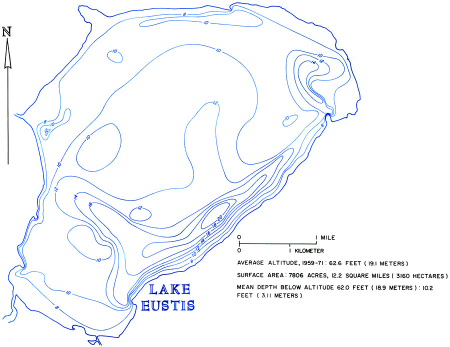
Description: This is a map showing Lake Eustis in Lake County, current to 1974. It shows its average altitude, surface area and mean depth below altitude. "The quality of lakes Eustis and Griffin is better than that of the lakes upstream of Dora Canal because water of relatively good quality from Lake Harris dilutes the water of poorer quality from Lake Dora." — Florida Bureau of Geology Please see the article Hydrology of the Oklawaha Lakes Area of Florida by P. W. Bush for more information.
Source: U. S. Geological Survey, Bureau of Geology, Florida Department of Natural Resources, Florida Bureau of Geology (Tallahassee, FL: Florida Bureau of Geology, 1974)
Map Credit: Courtesy the University of South Florida Library |
|