Title: Ground-Water Features in Escambia and Santa Rosa Counties, Florida- Figure 6
Projection: Unknown
Source Bounding Coordinates:
W: -87.5 E: -86.5 N: 31 S: 30 |
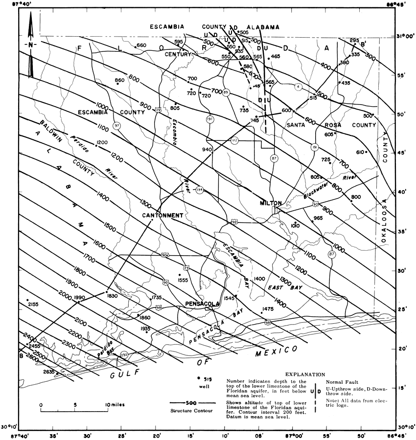
| | Description: This is a map showing the top of the lower limestone of the Floridian aquifer in Escambia and Santa Rosa counties, current to 1967. "The contours show that this limestone becomes deeper toward the southwest at about 35 feet per mile. This limestone aquifer thins toward the Gulf of Mexico and ranges in thickness from 360 to 1,200 feet." — Florida Bureau of Geology Please see the article Ground-Water Features in Escambia and Santa Rosa Counties, Florida by Jack T. Barraclough for more information.
Source: U. S. Geological Survey, Bureau of Geology, Florida Department of Natural Resources, Florida Bureau of Geology (Tallahassee, FL: Florida Bureau of Geology, 1967)
Map Credit: Courtesy the University of South Florida Library |
| |
| FL Maps > Region > 1950-1999 > Ground-Water Features in Escambia and Santa Rosa Counties, Florida- Figure 6, 1967 | |
|