Title: Ground-Water Features in Escambia and Santa Rosa Counties, Florida- Figure 8
Projection: Unknown
Source Bounding Coordinates:
W: -87.5 E: -86.5 N: 31 S: 30 |
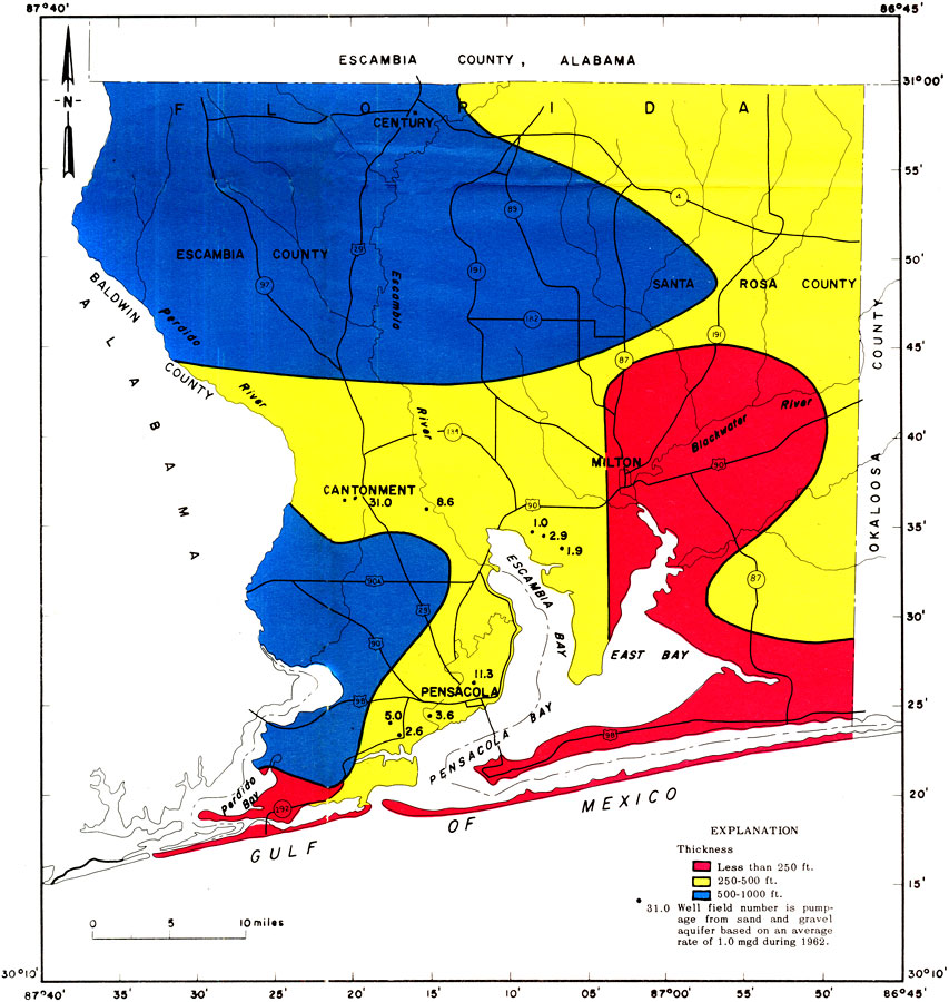
| | Description: This is a map showing thickness of the sand-and-gravel aquifer and average pumping rates of the larger well fields in Escambia and Santa Rosa counties, current to 1967. "The colors show the general thickness of the sand-and-gravel aquifer in feet below the land surface. This aquifer is 1,000 feet thick in the north and much thinner along the Gulf of Mexico." — Florida Bureau of Geology Please see the article Ground-Water Features in Escambia and Santa Rosa Counties, Florida by Jack T. Barraclough for more information.
Source: U. S. Geological Survey, Bureau of Geology, Florida Department of Natural Resources, Florida Bureau of Geology (Tallahassee, FL: Florida Bureau of Geology, 1967)
Map Credit: Courtesy the University of South Florida Library |
| |
| FL Maps > Region > 1950-1999 > Ground-Water Features in Escambia and Santa Rosa Counties, Florida- Figure 8, 1967 | |
|