Title: Ground-Water Features in Escambia and Santa Rosa Counties, Florida- Figure 9
Projection: Unknown
Source Bounding Coordinates:
W: -87.5 E: -86.5 N: 31 S: 30 |
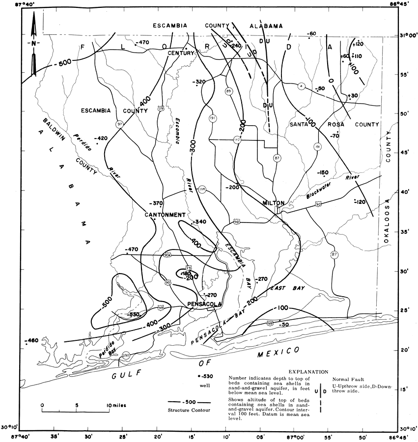
| | Description: This is a map showing the top of the beds in the sand-and-gravel aquifer that contain sea shells in Escambia and Santa Rosa counties, current to 1967. "The contour lines represent the top of the beds in the sand-and-gravel aquifer that contain fossil sea shells. Above this surface, the beds lack shells and below it, the beds may be composed of 50 percent shells. Near the Gulf of Mexico, the shell beds occur near the surface." — Florida Bureau of Geology Please see the article Ground-Water Features in Escambia and Santa Rosa Counties, Florida by Jack T. Barraclough for more information.
Source: U. S. Geological Survey, Bureau of Geology, Florida Department of Natural Resources, Florida Bureau of Geology (Tallahassee, FL: Florida Bureau of Geology, 1967)
Map Credit: Courtesy the University of South Florida Library |
| |
| FL Maps > Region > 1950-1999 > Ground-Water Features in Escambia and Santa Rosa Counties, Florida- Figure 9, 1967 | |
|