Title: Ground-Water Features in Escambia and Santa Rosa Counties, Florida- Figure 12
Projection: Unknown
Source Bounding Coordinates:
W: -87.5 E: -86.5 N: 31 S: 30 |
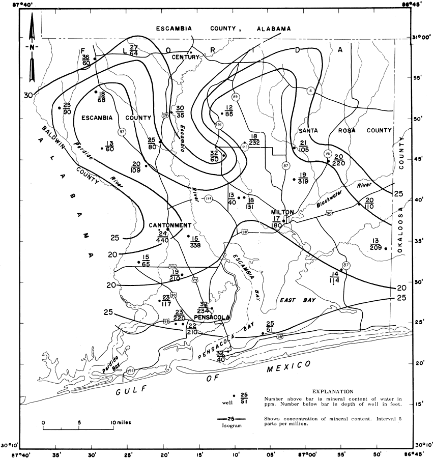
| | Description: This is a map showing mineral content of water from the upper part of the sand-and-gravel aquifer in Escambia and Santa Rosa counties, current to 1967. "Contours show equal amounts of mineral matter dissolved in water from the upper part of the sand-and-gravel aquifer, the part above the sea shell beds. The water containing the least minerals comes from the central part of the area where recharge is large. Most of the water in the aquifer is exceptionally soft and slightly mineralized." — Florida Bureau of Geology Please see the article Ground-Water Features in Escambia and Santa Rosa Counties, Florida by Jack T. Barraclough for more information.
Source: U. S. Geological Survey, Bureau of Geology, Florida Department of Natural Resources, Florida Bureau of Geology (Tallahassee, FL: Florida Bureau of Geology, 1967)
Map Credit: Courtesy the University of South Florida Library |
| |
| FL Maps > Region > 1950-1999 > Ground-Water Features in Escambia and Santa Rosa Counties, Florida- Figure 12, 1967 | |
|