Title: Ground-Water Features in Escambia and Santa Rosa Counties, Florida- Figure 13
Projection: Unknown
Source Bounding Coordinates:
W: -87.5 E: -86.5 N: 31 S: 30 |
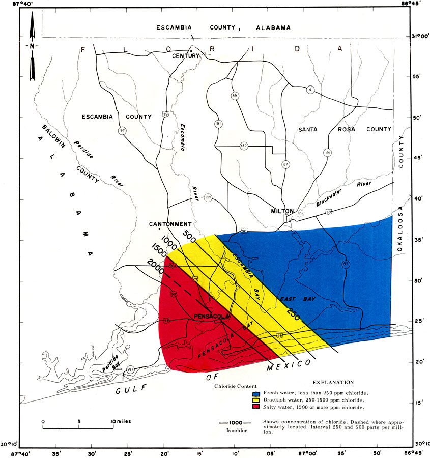
| | Description: This is a map showing chloride content of water from the upper limestone of the Floridian aquifer in Escambia and Santa Rosa counties, current to 1967. "Water from the upper limestone, in the blue colored area, is suitable for most uses. In the yellow colored area, water from the upper limestone is suitable for some uses but generally not for drinking. Water in the red colored area is too salty for almost all uses." — Florida Bureau of Geology Please see the article Ground-Water Features in Escambia and Santa Rosa Counties, Florida by Jack T. Barraclough for more information.
Source: U. S. Geological Survey, Bureau of Geology, Florida Department of Natural Resources, Florida Bureau of Geology (Tallahassee, FL: Florida Bureau of Geology, 1967)
Map Credit: Courtesy the University of South Florida Library |
| |
| FL Maps > Region > 1950-1999 > Ground-Water Features in Escambia and Santa Rosa Counties, Florida- Figure 13, 1967 | |
|