Title: Ground-Water Features in Escambia and Santa Rosa Counties, Florida- Figure 15
Projection: Unknown
Source Bounding Coordinates:
W: -87.5 E: -86.5 N: 31 S: 30 |
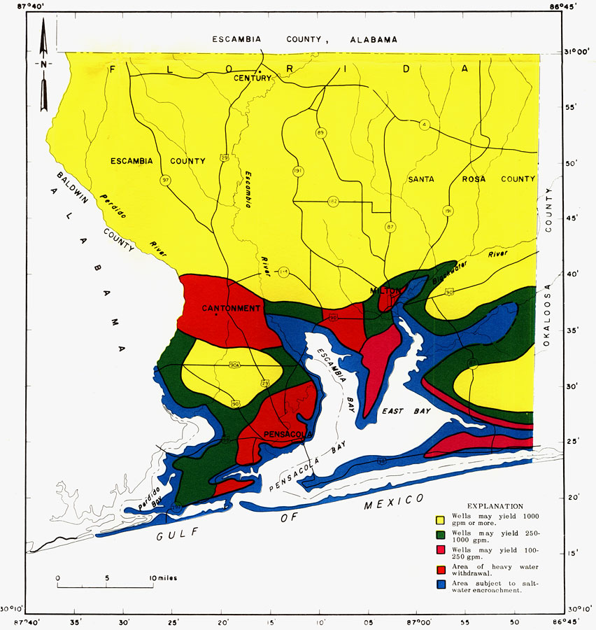
| | Description: This is a map showing general areas of water availability in the sand-and-gravel aquifer in Escambia and Santa Rosa counties, current to 1967. "Most large capacity wells in the yellow area would be successful because the sand-and-gravel aquifer is permeable and thick. The possibility of salt-water encroachment restricts the amount of water that can be withdrawn from the green area. The red color indicates areas where yields of 100 to 250 gpm can safely be pumped without danger of salt-water encroachment. The blue color indicates where pumping of large wells could cause salt water from nearby bays, rivers, or the Gulf of Mexico to move into the aquifer. The orange color indicates where large quantities of ground water are presently being pumped." — Florida Bureau of Geology Please see the article Ground-Water Features in Escambia and Santa Rosa Counties, Florida by Jack T. Barraclough for more information.
Source: U. S. Geological Survey, Bureau of Geology, Florida Department of Natural Resources, Florida Bureau of Geology (Tallahassee, FL: Florida Bureau of Geology, 1967)
Map Credit: Courtesy the University of South Florida Library |
| |
| FL Maps > Region > 1950-1999 > Ground-Water Features in Escambia and Santa Rosa Counties, Florida- Figure 15, 1967 | |
|