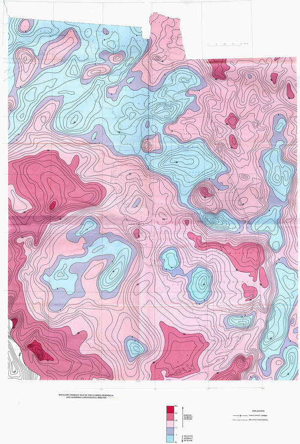
Description: This is a Bouguer Anomaly map of the Florida peninsula and adjoining continental shelves, current to 1972. These types of maps show variations in gravity from place to place using the Bouguer anomaly created by Pierre Bouguer. "This map was prepared from data supplied by the Department of Defense Gravity Library and incorporates the previous data published as Map Series No. 41, 1971, by the Bureau of Geology, Florida Department of Natural Resources." — Chaki, Ball & Oglesby Please see the article Bouguer Anomaly Map of the Florida Peninsula and Adjoining Continental Shelves by Susan Chaki, M. M. Ball and Woodson R. Oglesby for more information.
Source: U. S. Geological Survey, Bureau of Geology, Florida Department of Natural Resources, Florida Bureau of Geology (Tallahassee, FL: Florida Bureau of Geology, 1972)
Map Credit: Courtesy the University of South Florida Library |
|