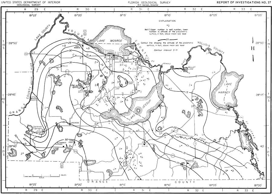
Description: This map shows the piezometric surface of the Floridian aquifer in Seminole County in June 1956. "Figure 8 shows the piezometric surface of the Floridian aquifer at near record-high conditions in June 1956. It shows a piezometric high near Golden and Silver lakes, 3.5 miles south of Sanford, which indicates that this is a recharge area." — Jack T. Barraclough, U. S. Geological Survey, 1962
Source: Jack T. Barraclough, U. S. Geological Survey, Ground-Water Resources of Seminole County, Florida (Tallahassee, FL: Florida Geological Survey, 1962)
Map Credit: Courtesy the University of South Florida Library |
|