mapsExploring Florida
 FL Maps > State > 1900-1919 > Florida, 1902
Site Map 

Florida, 1902


Puzzle Directions: Click on a puzzle piece and drag it where you want it. When you connect two pieces correctly, they will join together. Mix up the pieces again. View finished map in pop-up window.

Title: Florida
Projection: Unknown
Source Bounding Coordinates:
W: -85 E: -80 N: 31 S: 24.2

Back to Map Page
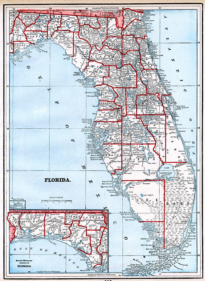
Description: A map of Florida State, displaying county borders, county seats, and railroads current to 1902. The Panhandle is present as an inset in the bottom left corner of the map.
Source: George F. Cram, (Chicago, Il: George F. Cram, 1902)
Map Credit: Courtesy the private collection of Roy Winkelman.
SearchLicensePDF HelpGIS Help Google Earth Help Zoomify Help

 FL Maps > State > 1900-1919 > Florida, 1902