mapsExploring Florida
 FL Maps > County > Sarasota > Specific Conductance of Intermediate Aquifer Well Water from Permeable Zone 3 in Southwest Sarasota County, 1996
Site Map 

Specific Conductance of Intermediate Aquifer Well Water from Permeable Zone 3 in Southwest Sarasota County, 1996


Puzzle Directions: Click on a puzzle piece and drag it where you want it. When you connect two pieces correctly, they will join together. Mix up the pieces again. View finished map in pop-up window.

Title: Specific Conductance of Intermediate Aquifer Well Water from Permeable Zone 3 in Southwest Sarasota County
Projection: Albers_Conical_Equal
Source Bounding Coordinates:
W: -82.75 E: -82 N: 27.25 S: 26.75

Back to Map Page
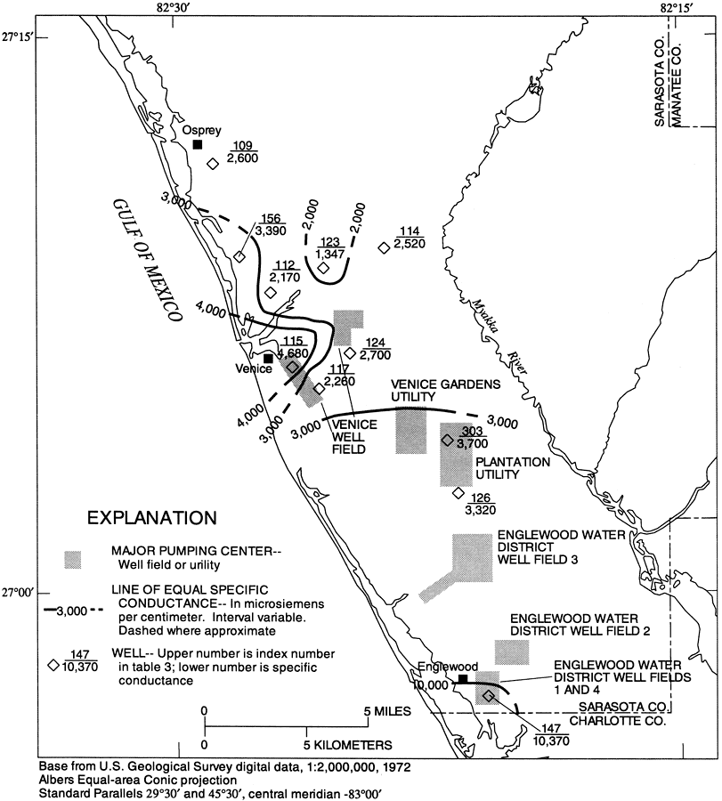
Description: This map from the U. S. Geological Survey Water Resources Investigation Report number 96-4063, Hydrology of the Surficial and Intermediate Aquifer Systems in Sarasota and Adjacent Counties, shows the major well fields or utility pumping centers in southwest Sarasota County, and specific conductance of water measured in microSiemens per centimeter at 25 degrees Celsius taken from wells open to the intermediate aquifer system, permeable zone 3. Well symbols are shown with their corresponding well number and the specific conductance. Lines delineate areas of equal specific conductance. The map scale is 1:2,000,000.
Source: G. L. Barr, USGS Water Resources Investigations Report 96-4063 (Tallahassee, FL: U. S. Geological Survey, 1996) 57
Map Credit: Courtesy the University of South Florida Library
SearchLicensePDF HelpGIS Help Google Earth Help Zoomify Help

 FL Maps > County > Sarasota > Specific Conductance of Intermediate Aquifer Well Water from Permeable Zone 3 in Southwest Sarasota County, 1996