Title: Stormwater Drains, Winter Park Chain of Lakes
Projection: Unknown
Source Bounding Coordinates:
W: -81.22 E: -81.20 N: 28.38 S: 28.34 |
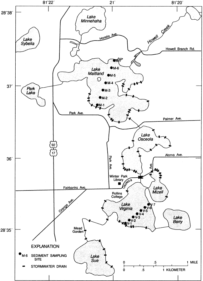
| | Description: This map from the U. S. Geological Survey Water Resources Investigation Report number 95-4108, Water Budgets, Water Quality, and Analysis of Nutrient Loading of the Winter Park Chain of Lakes, shows the locations of the 69 stormwater drains that empty directly into the lake system, and the location of bottom-sampling sites used to gather data for the report.
Source: G. G. Phelps and E. R. German, USGS Water Resources Investigations Report 95-4108 (Tallahassee, FL: U. S. Geological Survey, 1995) 9
Map Credit: Courtesy the University of South Florida Library |
| |
|