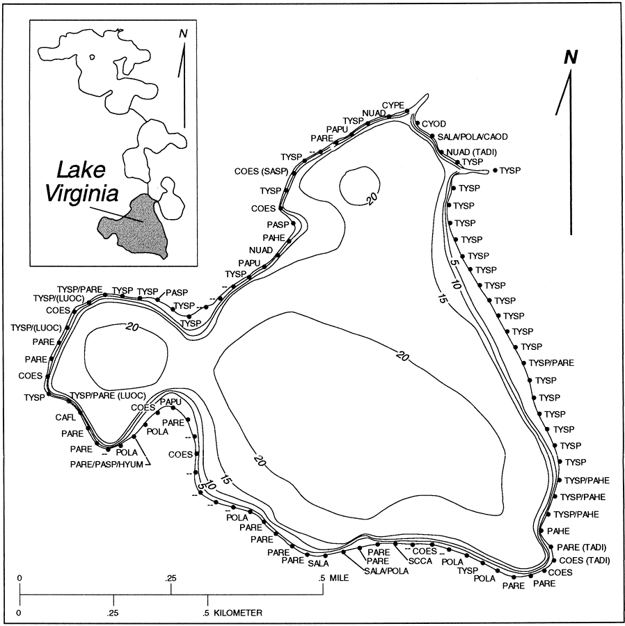
Description: This map from the U. S. Geological Survey Water Resources Investigation Report number 95-4108, Water Budgets, Water Quality, and Analysis of Nutrient Loading of the Winter Park Chain of Lakes, shows the bathymetry and near shore vegetation of Lake Virginia, Orange County, Florida. The contour lines show areas of equal depth below the lake surface in intervals of 5 feet. The lake surface elevation in March, 1992 was about 66 feet above sea level. Dominant species of littoral vegetation are shown and keyed with a species code, scientific name, and common name.
Source: G. G. Phelps and E. R. German, USGS Water Resources Investigations Report 95-4108 (Tallahassee, FL: U. S. Geological Survey, 1995) Plate 2
Map Credit: Courtesy the University of South Florida Library |
|