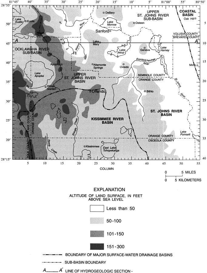
Description: This map from the U. S. Geological Survey Water Resources Investigation Report number 96-4181, Hydrogeologic Conditions and Simulation of Ground Water Flow in the Greater Orlando Metropolitan Area, shows the generalized topography of the area by altitude of land surface in feet above sea level, and the boundaries of major surface-water drainage basins and sub-basins. The major basins include the Kissimmee River Basin, St. Johns River Basin, and a portion of the Coastal Basin. The sub-basins include the Upper St. Johns River Sub-basin and the Ocklawaha River Sub-basin.
Source: L. C. Murray, Jr. and Keith J. Halford, USGS Water Resources Investigations Report 96-4181 (Tallahassee, FL: U. S. Geological Survey, 1996) 7
Map Credit: Courtesy the University of South Florida Library |
|