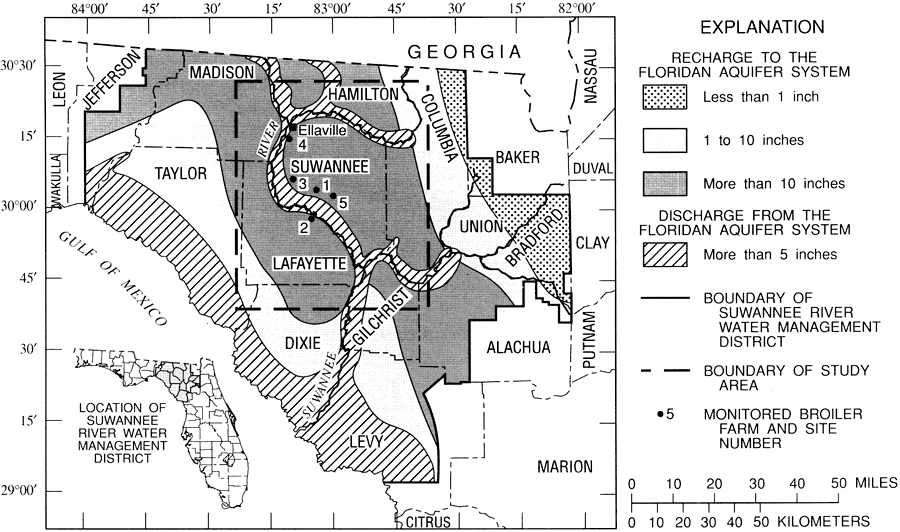
Description: This map from the U. S. Geological Survey Water Resources Investigation Report number 95-4064, Effects of Waste-Disposal Practices on Ground-Water Quality at Five Poultry Farms in North-Central Florida, shows the yearly rates of recharge to and discharge from the Floridan aquifer system, measured in inches, within the Suwannee River Water Management District.
Place Names: 1950-1999, Suwannee County, Lafayette County, Madison County, Taylor County, Dixie County, Levy County, Gilchrist County, Columbia County, Union County, Bradford County, Ellaville,
ISO Topic Categories: boundaries, geoscientificInformation, inlandWaters
Keywords: Rates of Recharge and Discharge to the Floridan Aquifer System in the Suwannee River Water Management District, physical, political, hydrological, khydrology, physical features, geological, county borders, water table, drainage basins, boundaries, geoscientificInformation, inlandWaters, Unknown,1995
Source: Hilda H. Hatzell, USGS Water Resources Investigations Report 95-4064 (Tallahassee, FL: U. S. Geological Survey, 1995) 3
Map Credit: Courtesy the University of South Florida Library |
|
