mapsExploring Florida
 FL Maps > Region > 1950-1999 > Rates of Recharge and Discharge to the Floridan Aquifer System in the Suwannee River Water Management District, 1995
Site Map 

Rates of Recharge and Discharge to the Floridan Aquifer System in the Suwannee River Water Management District, 1995


Puzzle Directions: Click on a puzzle piece and drag it where you want it. When you connect two pieces correctly, they will join together. Mix up the pieces again. View finished map in pop-up window.

Title: Rates of Recharge and Discharge to the Floridan Aquifer System in the Suwannee River Water Management District
Projection: Unknown
Source Bounding Coordinates:
W: -84.15 E: -81.45 N: 30.45 S: 28.45

Back to Map Page
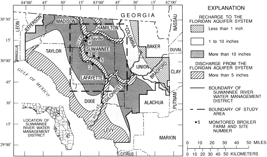
Description: This map from the U. S. Geological Survey Water Resources Investigation Report number 95-4064, Effects of Waste-Disposal Practices on Ground-Water Quality at Five Poultry Farms in North-Central Florida, shows the yearly rates of recharge to and discharge from the Floridan aquifer system, measured in inches, within the Suwannee River Water Management District.
Source: Hilda H. Hatzell, USGS Water Resources Investigations Report 95-4064 (Tallahassee, FL: U. S. Geological Survey, 1995) 3
Map Credit: Courtesy the University of South Florida Library
SearchLicensePDF HelpGIS Help Google Earth Help Zoomify Help

 FL Maps > Region > 1950-1999 > Rates of Recharge and Discharge to the Floridan Aquifer System in the Suwannee River Water Management District, 1995