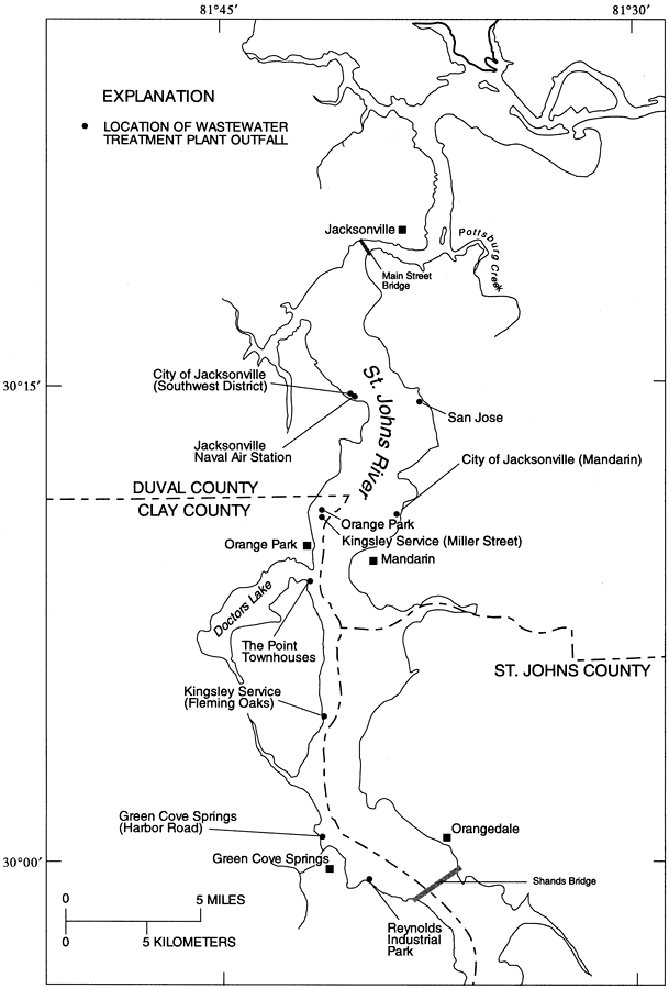
Description: This map from the U. S. Geological Survey Water Resources Investigation Report number 95-4257, Detection of Groundwater Discharge, shows the locations of the wastewater treatment plant outfalls to the St. Johns River between Jacksonville and Green Cove Springs.
Place Names: 1950-1999, Duval County, Clay County, St. Johns County, St. Johns River, Jacksonville, Orangedale, Green Cove Springs, Orange Park, Mandarine
ISO Topic Categories: boundaries, geoscientificInformation, inlandWaters
Keywords: Location of Wastewater Treatment Plant Outfalls to the St. Johns River, physical, political, hydrological, khydrology, physical features, county borders, boundaries, geoscientificInformation, inlandWaters, Unknown,1996
Source: Rick M. Spechler, USGS Water Resources Investigations Report 95-4257 (Tallahassee, FL: U. S. Geological Survey, 1996) 17
Map Credit: Courtesy the University of South Florida Library |
|