mapsExploring Florida
 FL Maps > Region > 1950-1999 > Location of Wastewater Treatment Plant Outfalls to the St. Johns River, 1996
Site Map 

Location of Wastewater Treatment Plant Outfalls to the St. Johns River, 1996


Puzzle Directions: Click on a puzzle piece and drag it where you want it. When you connect two pieces correctly, they will join together. Mix up the pieces again. View finished map in pop-up window.

Title: Location of Wastewater Treatment Plant Outfalls to the St. Johns River
Projection: Unknown
Source Bounding Coordinates:
W: -82 E: -81.30 N: 30.30 S: 30

Back to Map Page
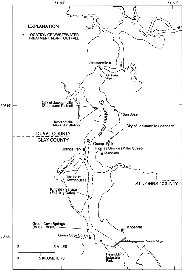
Description: This map from the U. S. Geological Survey Water Resources Investigation Report number 95-4257, Detection of Groundwater Discharge, shows the locations of the wastewater treatment plant outfalls to the St. Johns River between Jacksonville and Green Cove Springs.
Source: Rick M. Spechler, USGS Water Resources Investigations Report 95-4257 (Tallahassee, FL: U. S. Geological Survey, 1996) 17
Map Credit: Courtesy the University of South Florida Library
SearchLicensePDF HelpGIS Help Google Earth Help Zoomify Help

 FL Maps > Region > 1950-1999 > Location of Wastewater Treatment Plant Outfalls to the St. Johns River, 1996