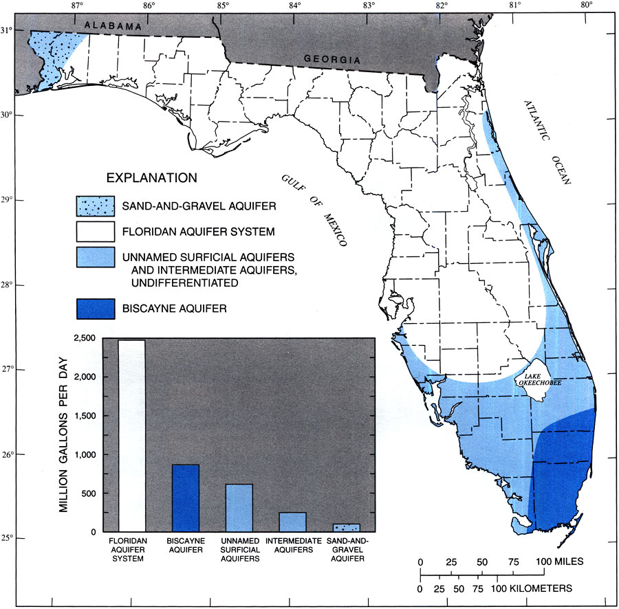
Description: This map from the U. S. Geological Survey Water Resources Investigation Report number 99-4002, Water Withdrawals, Use, Discharge and Trends in Florida, 1995, shows the approximate areal extent over which principal aquifers in Florida are the primary source of groundwater and the quantity of groundwater withdrawals in 1995. This map is modified from Vecchioli and Foose, 1985.
Place Names: 1950-1999,
ISO Topic Categories: boundaries, geoscientificInformation, inlandWaters, oceans
Keywords: Extent of Principal Aquifers in Florida, physical, political, hydrological, khydrology, physical features, major political subdivisions, county borders, boundaries, geoscientificInformation, inlandWaters, oceans, Unknown,1995
Source: Richard L. Marella, USGS Water Resources Investigations Report 99-4002 (Tallahassee, FL: U. S. Geological Survey, 1999) 10
Map Credit: Courtesy the University of South Florida Library |
|