mapsExploring Florida
 FL Maps > Region > 1950-1999 > Chlorine Concentrations in Groundwater of the Suwannee River Water Management District, 1998
Site Map 

Chlorine Concentrations in Groundwater of the Suwannee River Water Management District, 1998


Puzzle Directions: Click on a puzzle piece and drag it where you want it. When you connect two pieces correctly, they will join together. Mix up the pieces again. View finished map in pop-up window.

Title: Chlorine Concentrations in Groundwater of the Suwannee River Water Management District
Projection: Unknown
Source Bounding Coordinates:
W: -84.5 E: -82 N: 31 S: 29

Back to Map Page
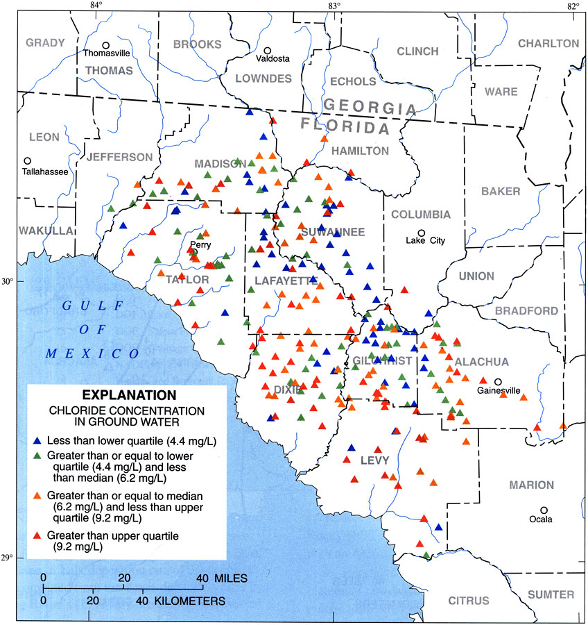
Description: This map from the U. S. Geological Survey Water Resources Investigation Report number 97-4283, Recharge Rates to the Upper Floridan Aquifer in the Suwannee River Water Management District, shows the quartile levels of groundwater chloride concentrations measured in milligrams per Liter.
Source: J. W. Grubbs, USGS Water Resources Investigations Report 97-4283 (Tallahassee, FL: U. S. Geological Survey, 1998) 11
Map Credit: Courtesy the University of South Florida Library
SearchLicensePDF HelpGIS Help Google Earth Help Zoomify Help

 FL Maps > Region > 1950-1999 > Chlorine Concentrations in Groundwater of the Suwannee River Water Management District, 1998