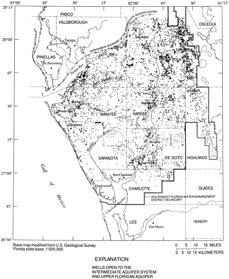
Description: This map from the U. S. Geological Survey Water Resources Investigation Report number 96-4030, Potential for Water-Quality Degradation of Interconnected Aquifers in West-Central Florida, shows the locations in west-central Florida of wells that are open to the intermediate and Upper Floridan aquifer systems. The map also shows the approximate boundary of the intermediate aquifer system in the region. Thousands of deep artesian wells were drilled into the Upper Floridan aquifer in west-central Florida prior to well-drilling regulations, and were left open to multiple aquifers containing water of varying quality. These open boreholes serve as a potential source of water quality degradation. The map scale is 1:500,000.
Source: P. A. Metz and D. L. Brendle, USGS Water Resources Investigations Report 96-4030 (Tallahassee, FL: U. S. Geological Survey, 1996) 49
Map Credit: Courtesy the University of South Florida Library |
|