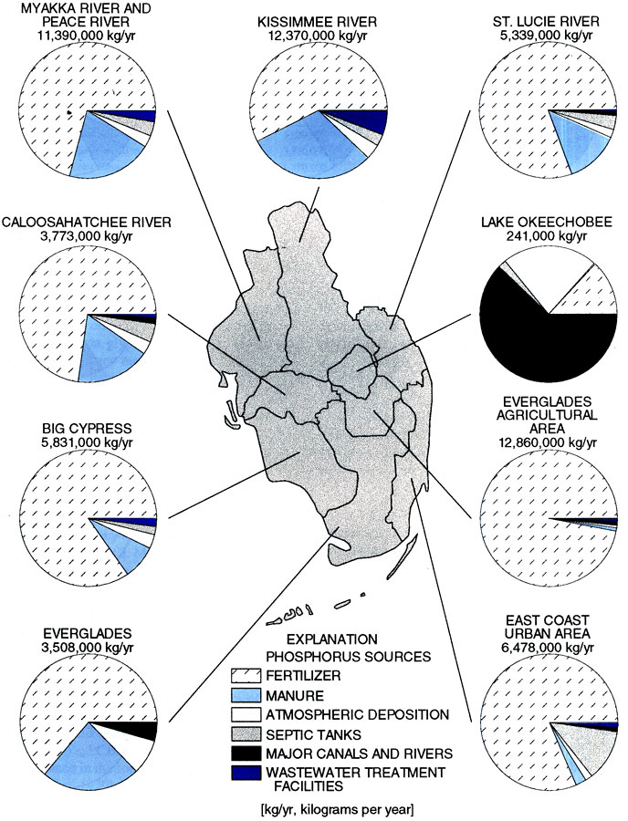
Description: This map from the U. S. Geological Survey Water Resources Investigation Report number 96-4177, Water-Quality Assessment of Southern Florida, shows the estimated phosphorus loading from both point and non-point sources in surface-water basins in southern Florida measured in kilograms per year. The sources of phosphorus are broken down as fertilizer, manure, atmospheric deposition, septic tanks, major canals and rivers, and wastewater treatment facilities.
Source: K. H. Haag, R. L. Miller, L. A. Bradner, and D. S. McCulloch , USGS Water Resources Investigations Report 96-4177 (Tallahassee, FL: U. S. Geological Survey, 1996) 13
Map Credit: Courtesy the University of South Florida Library |
|