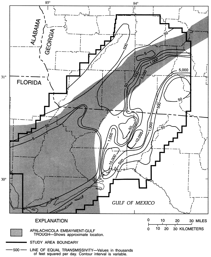
Description: This map from the U. S. Geological Survey Water Resources Investigation Report number 95-4296 shows the calibration-derived transmissivities of the Upper Floridan aquifer in the Leon County study area. The transmissivity values are shown in thousands of feet squared per day. This map also shows the approximate location of the Apalachicola Embayment-Gulf Trough feature. This feature has been described as a marine channel that once linked the Gulf of Mexico to the Atlantic Ocean during the early Tertiary, separating what we now know as Florida from the North American mainland.
Place Names: Leon, Tallahassee, Georgia, Gadsden County, Liberty County, Wakulla County, Franklin County, Jefferson County, Taylor County, Madison County, Calhoun County,
ISO Topic Categories: boundaries, geoscientificInformation, inlandWaters
Keywords: Transmissivity of the Upper Floridan Aquifer in Leon County, physical, political, hydrological, khydrlogical, physical features, geological, major political subdivisions, county borders, water table, boundaries, geoscientificInformation, inlandWaters, Unknown,1996
Source: Hal Davis, USGS Water Resources Investigations Report 95-4296 (Tallahassee, FL: U. S. Geological Survey, 1996) 39
Map Credit: Courtesy the University of South Florida Library |
|