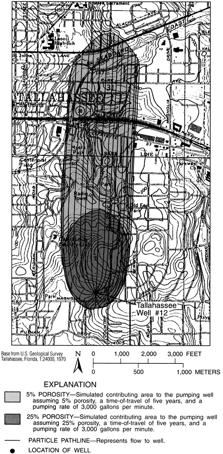
Description: This map from the U. S. Geological Survey Water Resources Investigation Report number 95-4296 shows the simulated contributing areas of water for the City of Tallahassee well number 12. The map shows areas of 5 per cent and 25 per cent porosity, and particle pathline flow to the well.
Place Names: Leon, Tallahassee
ISO Topic Categories: boundaries, geoscientificInformation, inlandWaters
Keywords: Water Contributing Areas to City of Tallahassee Well 12, physical, hydrological, khydrological, physical features, topographical, water table, boundaries, geoscientificInformation, inlandWaters, Unknown,1996
Source: Hal Davis, USGS Water Resources Investigations Report 95-4296 (Tallahassee, FL: U. S. Geological Survey, 1996) 52
Map Credit: Courtesy the University of South Florida Library |
|