mapsExploring Florida
 FL Maps > County > Miami-Dade > Location of Major Roads and Canals in Miami-Dade County, 2004
Site Map 

Location of Major Roads and Canals in Miami-Dade County, 2004


Puzzle Directions: Click on a puzzle piece and drag it where you want it. When you connect two pieces correctly, they will join together. Mix up the pieces again. View finished map in pop-up window.

Title: Location of Major Roads and Canals in Miami-Dade County
Projection: Unknown
Source Bounding Coordinates:
W: -81 E: -80 N: 26 S: 25

Back to Map Page
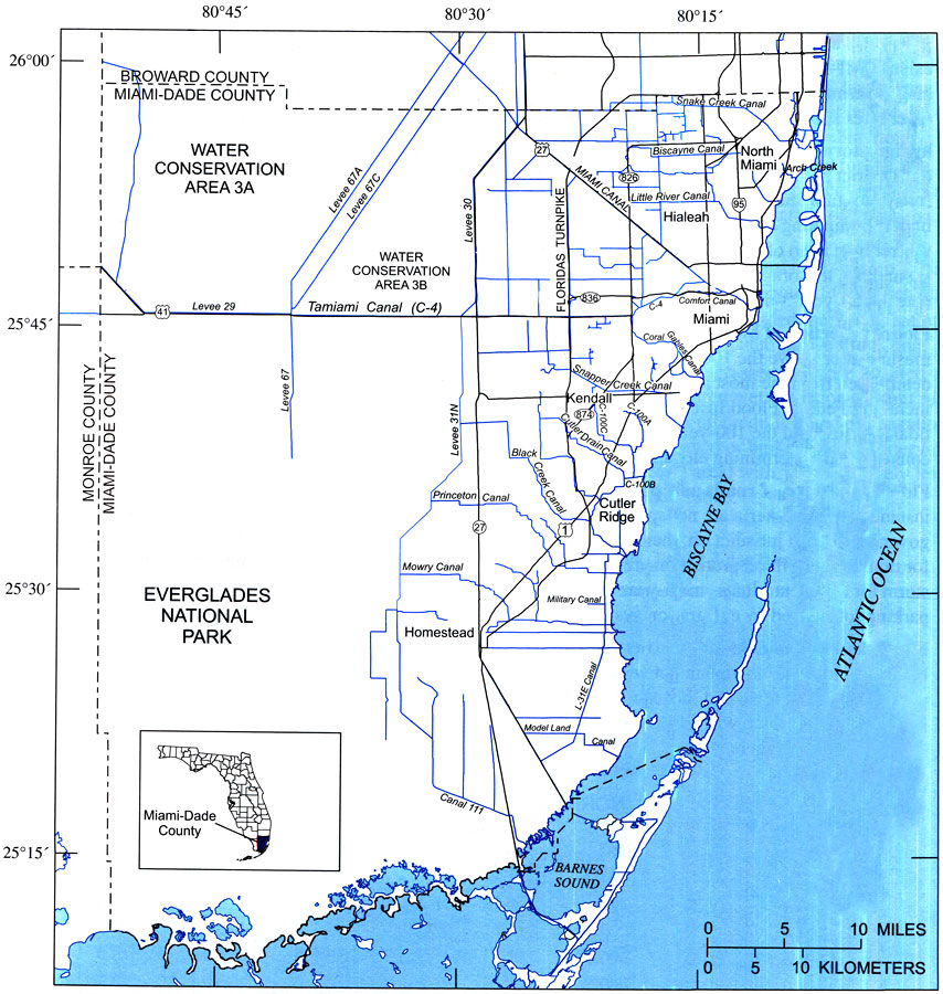
Description: This map from the U. S. Geological Survey Open-File Report number 2004-1346, An Overview of Urban Stormwater-Management Practices in Miami-Dade County, shows major roads and canal systems in the County, and the relationship between the two. The map also shows the significance of the south Florida canal system and its discharge to the Biscayne Bay.
Source: David A. Chin, USGS Open-File Report 2004-1346 (Reston, VA: U. S. Geological Survey, 2004) 5
Map Credit: Courtesy the University of South Florida Library
SearchLicensePDF HelpGIS Help Google Earth Help Zoomify Help

 FL Maps > County > Miami-Dade > Location of Major Roads and Canals in Miami-Dade County, 2004