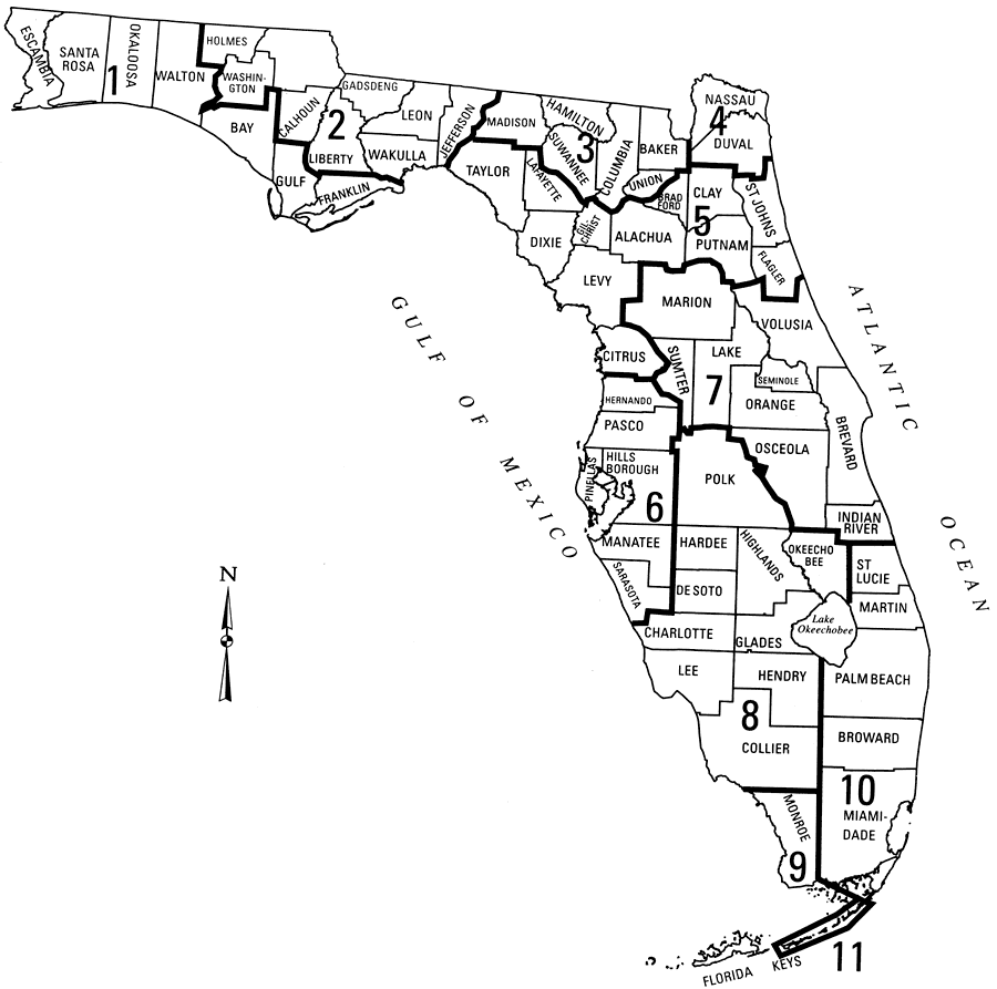
Description: This map from the U. S. Geological Survey Open-File Report number 2004-1346, An Overview of Urban Stormwater-Management Practices in Miami-Dade County, shows the 11 rainfall intensity zones as delineated by the Florida Department of Transportation. These rainfall zones are used to determine stormwater drainage design requirements for major or State roadways in Florida, and are based on precipitation intensity, duration, and frequency.
Place Names: 2000-,
ISO Topic Categories: boundaries, climatologyMeteorologyAtmosphere
Keywords: Florida Department of Transportation Rainfall Zones, physical, political, meteorological, kclimate, physical features, major political subdivisions, county borders, local jurisdictions, rainfall, boundaries, climatologyMeteorologyAtmosphere, Unknown,2004
Source: David A. Chin, USGS Open-File Report 2004-1346 (Reston, VA: U. S. Geological Survey, 2004) 9
Map Credit: Courtesy the University of South Florida Library |
|