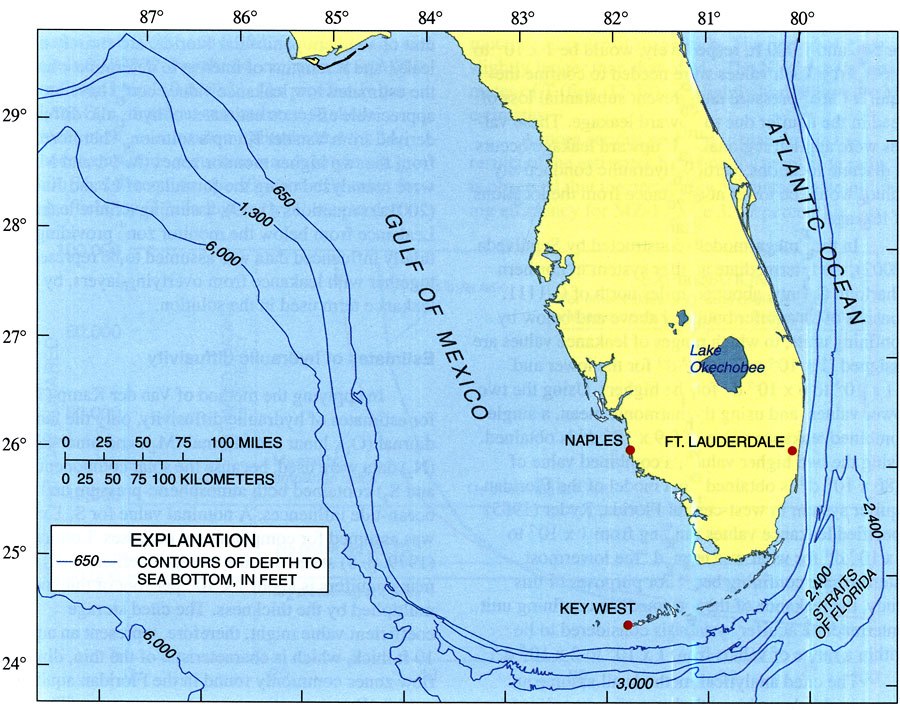
Description: This map from the U. S. Geological Survey Water Resources Investigation Report number 03-4267 shows the emerged peninsular Florida and contour lines showing the extent and slope of the submerged Florida Platform. The edge of the platform is indicated by the 6,000 foot depth contour, which is about 200 miles west to about 160 miles south of Naples. The top of the western extent of the submerged platform is about 650 feet below present-day sea level, about 165 miles west of Naples. To the east, the Florida Platform drops steeply east of Ft. Lauderdale.
Place Names: 2000-, Florida Platform, Naples, Ft. Lauderdale, Key West, Atlantic Ocean, Straits of Florida, Gulf of Mexico
ISO Topic Categories: boundaries, elevation, oceans
Keywords: The Florida Platform, physical, hydrological, khydrological, kgeophysical, physical features, topographical, water depths, boundaries, elevation, oceans, Unknown,2004-88
Source: Michael L. Merritt, USGS Water Resources Investigations Report 03-4267 (Tallahassee, FL: U. S. Geological Survey, 2004) 43
Map Credit: Courtesy the University of South Florida Library |
|