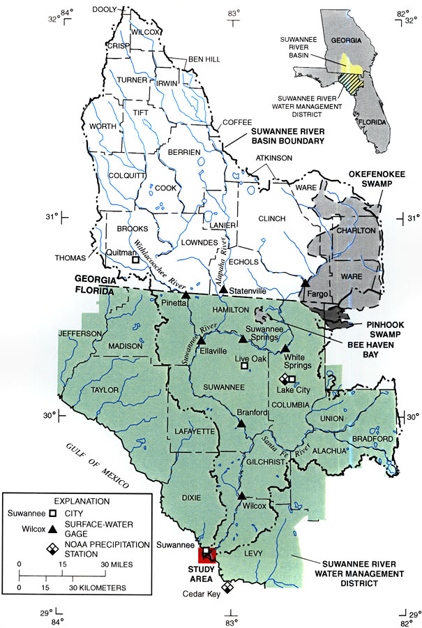
Description: This map from the U. S. Geological Survey Water Resources Investigation Report number 99-4268 shows both the Florida and Georgia sections of the Suwannee River Drainage Basin from the contributing watershed of its headwaters in the Okefenokee Swamp to its discharge in the Gulf of Mexico. The map also shows counties, cities and inland water systems, including the Suwannee River Water Management District.
Source: Gina M. Tillis, USGS Water Resources Investigations Report 99-4268 (Tallahassee, FL: U. S. Geological Survey, 2000) 3
Map Credit: Courtesy the University of South Florida Library |
|