mapsExploring Florida
 FL Maps > County > Palm Beach > Top of the Basal Hawthorn Unit in Palm Beach County, 2000
Site Map 

Top of the Basal Hawthorn Unit in Palm Beach County, 2000


Puzzle Directions: Click on a puzzle piece and drag it where you want it. When you connect two pieces correctly, they will join together. Mix up the pieces again. View finished map in pop-up window.

Title: Top of the Basal Hawthorn Unit in Palm Beach County
Projection: Unknown
Source Bounding Coordinates:
W: -81 E: -80 N: 27 S: 26.15

Back to Map Page
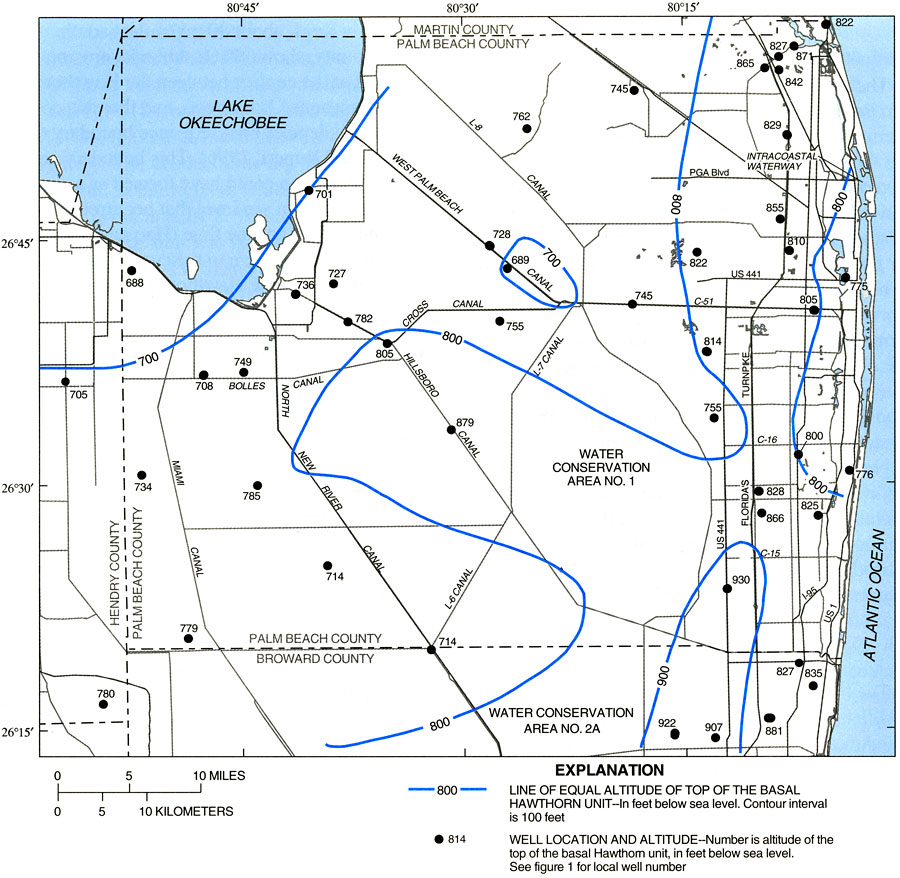
Description: This map from the U. S. Geological Survey Water Resources Investigation Report number 99-4061, Hydrology and the Distribution of Salinity in the Floridan Aquifer System, Palm Beach County, shows the altitude in feet below sea level of the top of the basal Eocene-aged Hawthorn unit in Palm Beach and northern Broward counties. Also shown on the map are well sites used in the study and the canal system in the county.
Source: R. S. Reese and S. J. Memberg, USGS Water Resources Investigations Report 99-4061 (Tallahassee, FL: U. S. Geological Survey, 2000) 16
Map Credit: Courtesy the University of South Florida Library
SearchLicensePDF HelpGIS Help Google Earth Help Zoomify Help

 FL Maps > County > Palm Beach > Top of the Basal Hawthorn Unit in Palm Beach County, 2000