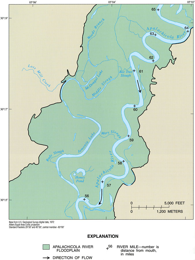
Description: This map from the U. S. Geological Survey Professional Paper number 1594, Aquatic Habitats in Relation to River Flow in the Apalachicola River Floodplain, shows the Apalachicola River floodplain of the Iamonia Lake intensive study area between Calhoun and Liberty Counties. This section of the river is in its middle reach, and is typified by broader meanders, evidence of remnant stream courses such as the oxbow lake named Honey Pond and the numerous sloughs, and relatively broad floodplain. River-mile markers are shown as distance from the river discharge into the Apalachicola Bay on the Gulf of Mexico. Smaller, contributing streams and sloughs are shown, including Lots Mill Creek, Rudy Slough, Mary Slough, McDougal Lake, and Iamonia Lake.
Source: H. M. Light, M. R. Darst, and J. W. Grubbs, USGS Professional Paper 1594 (Tallahassee, FL: U. S. Geological Survey, 1998) 30
Map Credit: Courtesy the University of South Florida Library |
|