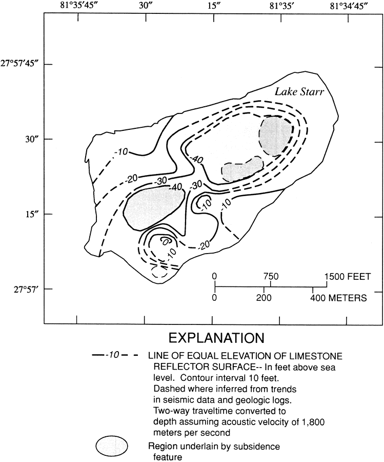
Description: This map from the U. S. Geological Survey Water Resources Investigation Report number 00-4030 shows lines of equal elevation of limestone reflector surface below Lake Starr in feet above sea level as interpreted from seismic-reflection profiles. Lake Starr, a 134-acre seepage lake of multiple sinkhole origin on the Lake Wales Ridge of central Florida, is typical of karst terrain lake hydrology in Florida, which is complex in its integral connection between surface and ground water.
Source: Amy Swancar, T. M. Lee, and T. M. O'Hare, USGS Water Resources Investigations Report 00-4030 (Tallahassee, FL: U. S. Geological Survey, 2000) 19
Map Credit: Courtesy the University of South Florida Library |
|