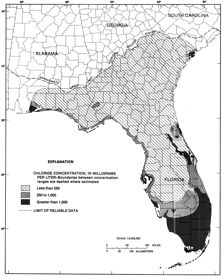
Description: This map from the U. S. Geological Survey Professional Paper 1403-1 shows the chloride concentrations in milligrams per liter in water from the upper 200 feet of the Floridan aquifer system, current to 1989. The diagonals show less than 250 mg/l, the light shaded area shows 250-1,000 mg/l and the dark shaded area shows greater than 1,000 mg/l. The upper 200 feet consists mostly of either Ocala or Suwannee Limestone. The main source of chloride is seawater.
Place Names: 1950-1999, counties
ISO Topic Categories: boundaries, geoscientificInformation
Keywords: Chloride Concentrations from the Upper 200 ft of the Floridan Aquifer Fig 22, physical, hydrological, kFloridan aquifer, political, khydrological, geological, county borders, boundaries, geoscientificInformation, Unknown,1989
Source: Craig L. Sprinkle, USGS Professional Paper 1403-1 (Washington, : U. S. Government Printing Office, 1989) 149
Map Credit: Courtesy the University of South Florida Library |
|