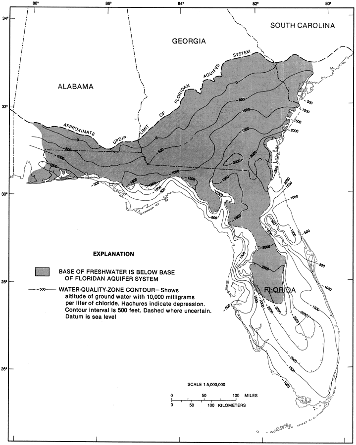
Description: This map from the U. S. Geological Survey Professional Paper 1403-1 shows the altitude of the estimated base of freshwater flow in the Floridan aquifer system, current to 1989. The shaded area shows that the base of freshwater flow is below the base of the Floridan aquifer system. Also shown are water quality zone contours in intervals of 500 feet. Hachures indicate depression. The base of freshwater flow is the midpoint of the saltwater-freshwater transition zone in coastal areas.
Place Names: 1950-1999, counties
ISO Topic Categories: geoscientificInformation
Keywords: Altitude of the Estimated Base of Freshwater Flow Fig 23, physical, hydrological, kFloridan aquifer, kaltitude, khydrological, geological, geoscientificInformation, Unknown,1989
Source: Craig L. Sprinkle, USGS Professional Paper 1403-1 (Washington, : U. S. Government Printing Office, 1989) 150
Map Credit: Courtesy the University of South Florida Library |
|