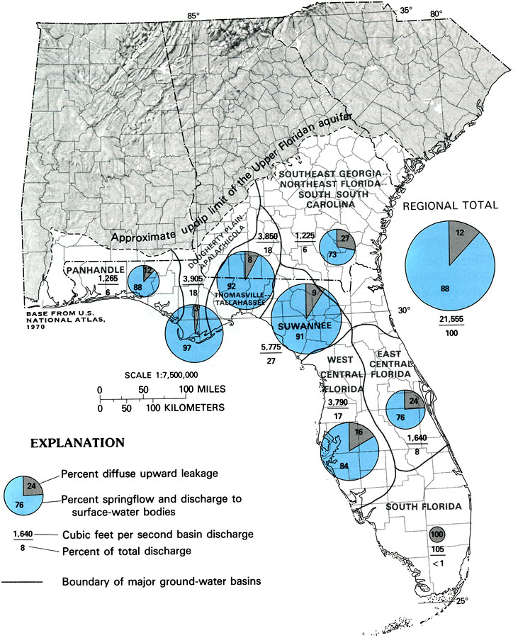
Description: This map from the U. S. Geological Survey Professional Paper 1403-C shows the estimated predevelopment discharge from major groundwater basins of the Upper Floridan aquifer system indicating the percentage of diffuse upward leakage and percentage of springflow and discharge to surface water bodies. Figures are given showing cubic feet per second basin discharge over the percent of total discharge.
Place Names: 1950-1999, counties
ISO Topic Categories: boundaries, geoscientificInformation, inlandWaters, oceans
Keywords: Estimated Predevelopment Discharge of the Upper Floridan Aquifer, physical, political, hydrological, khydrological, kFloridan aquifer, physical features, geological, major political subdivisions, county borders, water table, boundaries, geoscientificInformation, inlandWaters, oceans, Unknown,1988
Source: P. W. Bush and R. H. Johnston, USGS Professional Paper 1403-C (Washington, DC: U. S. Government Printing Office, 1988) C48
Map Credit: Courtesy the University of South Florida Library |
|