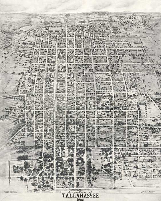
Description: An aero-view of the City of Tallahassee, the State Capital of Florida in 1926. This map orientation is from north to south, looking toward the Gulf of Mexico. From this point of view, south is toward the horizon. Perspective map not drawn to scale. General topography of the city is shown in this bird's-eye-view, along with the Capital Building, other major buildings, roads, and railways. Of special note is the Cherokee Hotel, the C. E. Daffin Theater, Governor’s Mansion, the I&M College, Florida State College for Women, and The Grove, the plantation home of "The Tallahassee Girl," Ellen Call Long, the first white child born in town.
Place Names: Leon, Bellair, Tallahassee
ISO Topic Categories: society, transportation
Keywords: An Aero-View of Tallahassee, physical, transportation, kbirdseye, kaerial, physical features, roads, society, transportation, Unknown,1926
Source: James Wynne, LC Panoramic maps (2nd ed.), 119 (, : n.p., 1926) 119
Map Credit: Courtesy of the Library of Congress |
|