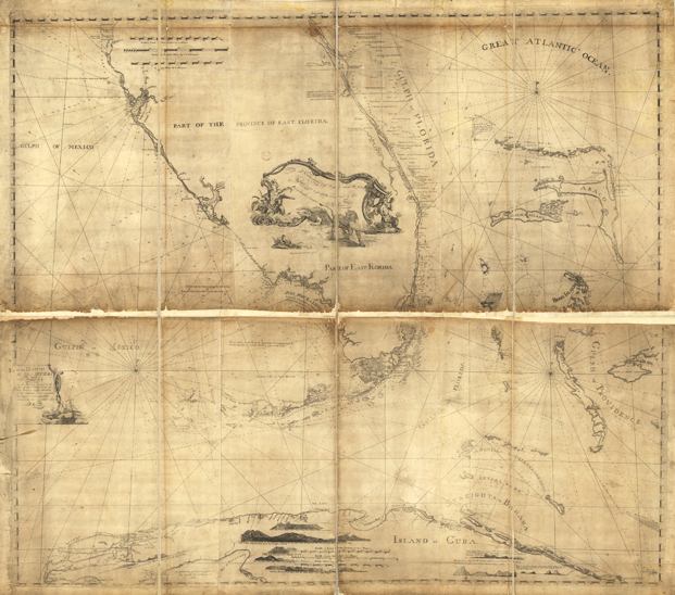
Description: This map drawn in 1774 is part of a two map set showing the southern peninsula of Florida with neighboring islands and waters. It is primarily a navigational chart with rhumblines, soundings, and coastal features. There are interesting labels such as the Atlantic Coast labeled the Gulph of Florida, and notations such as "The Water is here of a Saxon Blue Color" near the Florida Keys. Romans makes claim to several discoveries on this map, including the Peace and Myakka rivers in Charlotte Harbor "Creek discovered by the Author" and "Large River discovered by the Author," though he did not name them. The map includes sailing directions, notes on some shipwrecks, and 9 land identification profiles. Relief shown by hachures. Depths shown by soundings.
Place Names: 1780-1799, Tampe Bay, Tampa Bay, Charlotte Harbor, Boca Grand, Boca Captivo, Captiva, Cayos Vacas, Key Largo
ISO Topic Categories: inlandWaters, oceans, society, transportation
Keywords: Florida and its vicinity, physical, historical, transportation, physical features, water routes, inlandWaters, oceans, society, transportation, Unknown,1781
Source: Bernard Romans, A concise natural history of East and West Florida (New York, NY: Peter Force, 1781)
Map Credit: Courtesy of the Geography and Map Division of the Library of Congress |
|