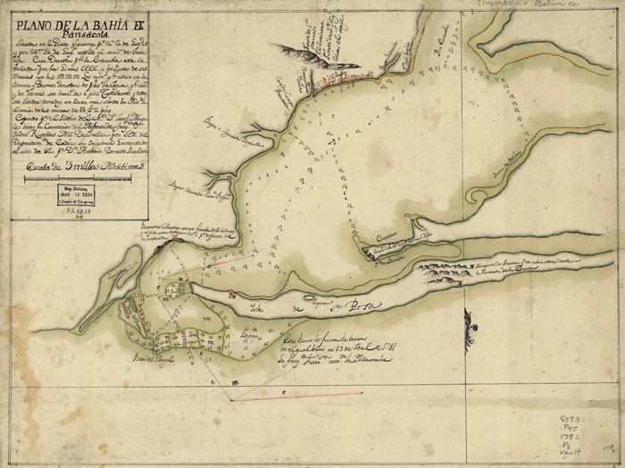
Description: This is a pen-and-ink and watercolor 1782 map of Pensacola Bay. It shows forts, churches, and Campbelltown pictorially, and includes sailing directions for entering the bay. Relief is shown pictorially, and depths are shown by soundings.
Place Names: 1780-1799, Pensacola
ISO Topic Categories: inlandWaters, oceans, society
Keywords: Plano de la bahia de Pansacola, physical, historical, transportation, physical features, water routes, inlandWaters, oceans, society, Unknown,1782
Source: Antonio Donato Paredes, (Cadiz, : , 1782)
Map Credit: Courtesy of the Geography and Map Division of the Library of Congress |
|