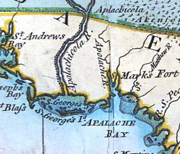
Description: A detail of the Apalachee Bay from a 1796 map of the West Indies showing Cape San Blas, St. George Sound, the Apalachicola River, and the site of St. Marks Fort.
Place Names: 1780-1799, St. Andres Bay, Apalachicola River, Apolache River, St. Marks Fort, St. Georges Sound, Apalache Bay, St. Georges Island
ISO Topic Categories: inlandWaters, oceans
Keywords: Detail - A general chart of the West Indies, physical, historical, physical features, inlandWaters, oceans, Unknown,1796
Source: Joseph Smith Speer, (London, : , 1796)
Map Credit: Courtesy of the Geography and Map Division of the Library of Congress |
|