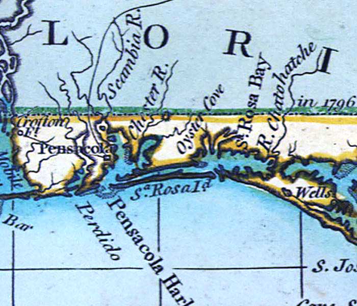
Description: A detail of the area between Pensacola Bay and Santa Rosa Bay from a 1796 map of the West Indies showing Pensacola, Santa Rosa Island, Oyster Cove, Scambia or Escambia River, and Santa Rosa Bay.
Place Names: 1780-1799, Pensacola, Perdido, Pensacola Harbor, Oyster Cove, Santa Rosa Island,
ISO Topic Categories: inlandWaters, oceans
Keywords: Detail - A general chart of the West Indies, physical, historical, physical features, inlandWaters, oceans, Unknown,1796
Source: Joseph Smith Speer, (London, : , 1796)
Map Credit: Courtesy of the Geography and Map Division of the Library of Congress |
|