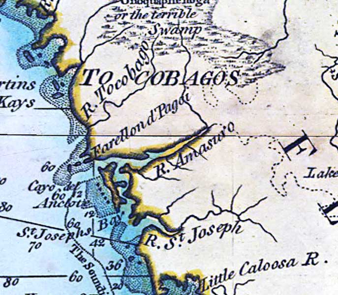
Description: A detail of the northwest Gulf Coast of Florida from a 1796 map of the West Indies showing St. Martins Kays, Cayo del Anclote, the traditional lands of the Tocobagos, and the "Onoquaphenoga or the terrible Swamp.". Depths shown by soundings.
Place Names: 1780-1799, St. Martins Kays, Cayo del Anclote, St. Joephs Bay
ISO Topic Categories: inlandWaters, oceans
Keywords: Detail - A general chart of the West Indies, physical, historical, physical features, inlandWaters, oceans, Unknown,1796
Source: Joseph Smith Speer, (London, : , 1796)
Map Credit: Courtesy of the Geography and Map Division of the Library of Congress |
|