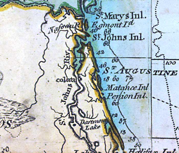
Description: A detail of the northeast Atlantic Coast of Florida from a 1796 map of the West Indies showing St. Marys Inlet, St. Johns Inlet, Matance or Matanzas Inlet, and St. Augustine. On this map, Amelia Island is shown as Egmont Island. Depths shown by soundings.
Place Names: 1780-1799, St. Marys Inlet, Egmont Island, St. Johns Inlet, Saint Augustine, Matance Inlet, Matanzas Inlet, Penion Inlet, Dartmouth Lake, St. Johns River, Colata, Nassau River
ISO Topic Categories: inlandWaters, oceans
Keywords: Detail - A general chart of the West Indies, physical, historical, physical features, inlandWaters, oceans, Unknown,1796
Source: Joseph Smith Speer, (London, : , 1796)
Map Credit: Courtesy of the Geography and Map Division of the Library of Congress |
|