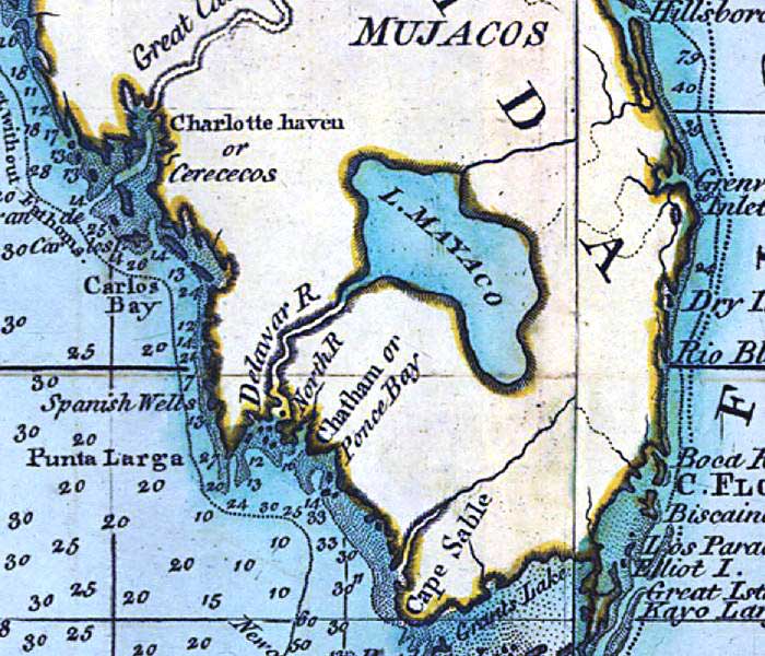
Description: A detail of the Gulf Coast of Florida between Cape Sable and Charlotte Harbor from a 1796 map of the West Indies. The map shows several names from the British occupation that are no longer used such as Lake Mayaco for Lake Okeechobee, Chatham Bay for Ponce de Leon Bay, and Cerececos for Charlotte Harbor. Depths shown by soundings.
Place Names: 1780-1799, Charlotte Haven, Charlotte Harbor, Cerececos, Great Caloosa River, Peace River, Delawar River, Caloosahatchee River, Lake Mayaco, Lake Okeechobee, Carlos Bay, Chatham Bay, Ponce Bay, Ponce de Leon Bay, Punta Larga, Cape Sable,
ISO Topic Categories: inlandWaters, oceans
Keywords: Detail - A general chart of the West Indies, physical, historical, physical features, inlandWaters, oceans, Unknown,1796
Source: Joseph Smith Speer, (London, : , 1796)
Map Credit: Courtesy of the Geography and Map Division of the Library of Congress |
|