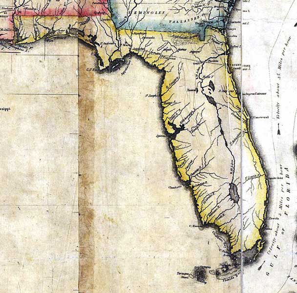
Description: A detail of the 1816 map "Map of the United States of America : with the contiguous British and Spanish possessions / compiled from the latest & best authorities by John Melish" showing the Spanish territory of Florida. This map shows coastal features, major lakes, rivers, and settlements. Relief is shown pictorially.
Place Names: 1800-1819, Santa Rosa Island, Deer Fort, Oyster Cove, Apalachicola River, St. Marks, St. Marys, Talbot Island, St. Augustine, Saint Augustine, Appalachee Bay, Apalachee Bay, Cape St. Blas, Cape San Blas, Cape Canaveral, Spiritu Santo Bay, Tampa Bay, Charlotte Harbor, Mayaco Lake, Lake Okeechobee, Chatham Bay, Cape Sable, Newcastle Key, Key West, West Key, Dry Tortugas
ISO Topic Categories: boundaries, inlandWaters, oceans, society
Keywords: Detail - Map of the United States of America , physical, political, historical, physical features, major political subdivisions, boundaries, inlandWaters, oceans, society, Unknown,1816
Source: John Melish, (Philadelphia, PA: John Melish, 1816)
Map Credit: Courtesy of the Geography and Map Division of the Library of Congress |
|