Maps Site map
  FL Maps > State > 1800-1819
Site Map  

  Record   1   to   8  of   8

Detail - A map exhibiting all the new discoveries in the interior parts of North America , 1802
This detail is from an 1802 hand-colored map of North America showing the various explorations and discoveries of the time. The map also indicates territories claimed by France and Spain. Relief shown by hachures. This detail shows the Spanish terri...

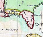
Detail - A map of North America, 1803
A detail from the 1802 map of territorial possessions of North America by J. Luffman from his Geographical Principles. The detail shows West and East Florida, St. Augustine, and Pensacola. ...

Detail - A map of the West Indies and of the Mexican-Gulph [sic], 1806
A detail from the 1806 map of the West Indies showing the Spanish territories of Floride Occidentale, or West Florida, and Floride Oriental, or East Florida. This map shows coastal features, major lakes and rivers, and settlements. Relief is shown pi...

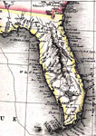
Detail - A map of the West Indies and of the Mexican-Gulph [sic], 1806
A detail from the 1806 map of the West Indies showing the Spanish territory of Floride Oriental, or East Florida. This map shows coastal features, major lakes and rivers, and settlements. Relief is shown pictorially. Various place names reflect Frenc...

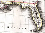
Carte des deux Florides et de la Louisiane inferieure, 1807
Digitization provided by the USF Libraries Digitization Center. Rare Maps Collection: G3330 1807 .P6 Full title of map is Carte des deux Florides et de la Louisiane inférieure : dressée pour les voyages de Mr. Robin dans les années 1802, 1803, 1804, ...

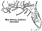
Jackson's Operations, 1814
Map shows the operations of Jackson during the early 1800's with in Florida territories. Shows major forts and cities that were present at this time in history. ...

Detail - Map of the United States of America , 1816
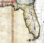
A detail of the 1816 map "Map of the United States of America : with the contiguous British and Spanish possessions / compiled from the latest & best authorities by John Melish" showing the Spanish territory of Florida. This map shows coast...

Cessions of Indian Lands, 1816 to 1830
A map of the cession of Native American lands in Florida. By 1823 the majority of the Native American lands had been ceded to the U.S. with a large reserve established in central peninsular Florida. ...


  FL Maps > State > 1800-1819
Site Map  

Maps ETC is a part of the Educational Technology Clearinghouse
Produced by the Florida Center for Instructional Technology © 2007
College of Education , University of South Florida